Spatial and health data are being used to monitor malaria in local areas to target vector control measures more effectively and meet health needs
Every year, from December to March, malaria wreaks havoc in the south-east of Madagascar. Mosquitoes proliferate during the rainy season, transmitting the disease from person to person. Measures such as targeting the flooded areas where mosquitoes lay their eggs to limit the development of larvae, and distributing health supplies according to needs, are crucial to saving lives.
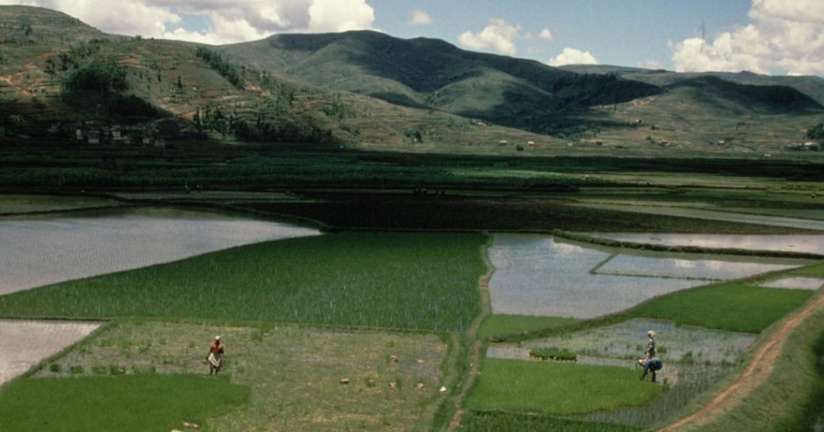
“We have statistical models capable of producing malaria forecasts several months in advance, both nationally and regionally. But they are powerless when it comes to guiding the actions of local response teams, who need to understand the dynamics of flooding in order to track down larval breeding sites among the thousands of rice fields in their area of operation. They also need to understand the dynamics of the seasonal epidemic, village by village, in order to target control measures or distribute rapid screening tests and treatment in the most effective way,” explains Andres Garchitorena, an epidemiologist with IRD’s MIVEGEC unit.
To address this twofold challenge, IRD scientists and their Madagascan partners have developed hyper-local decision support systems for early malaria warning and mosquito breeding site management. Integrating disease and flood dynamics in one district in the south-east of Madagascar, they have demonstrated the effectiveness of this approach in improving rural health systems. The information gathered through this alert system is accessible via web applications and available to health workers and vector management agents.
Counting cases in each village
Gauging the extent of an epidemic is no easy task! Data on cases is collected from health centres, but this raw information does not always reflect the dynamics of the disease. Statistical bias, due to underreporting of cases in villages far from health centres, needs to be corrected. Incorporating detailed environmental data, such as land flooding at a resolution of 10 metres, improves the reliability of predictions based solely on the number of cases in a village. The algorithms in this model were trained using monthly data from 195 fokontany between 2017 and 2020. The system is now populated automatically with health and environmental data, and is capable of predicting malaria cases up to three months in advance in each village. Transformed into relevant indicators for healthcare system stakeholders, these predictions make it possible to determine the quantities of medical supplies needed by each clinic and the number of cases remaining untreated in the district.
“By combining climate and health data, this early warning system can predict drug needs with more than 60% greater accuracy than the current system, which relies solely on health data. It has also reduced underestimation of needs by more than 50%, which is one of the main factors leading to stock shortages”, says Michelle Evans, a disease ecology specialist at the NGO Pivot and Harvard Medical School.
Tracking down larvae in rice fields
With mosquitoes evolving in terms of their behaviour and resistance to insecticides, traditional vector control measures are no longer sufficient. On top of mosquito control in homes and the use of insecticide-treated mosquito nets, the areas in which they breed must also be targeted. This requires vector control agents to be able to accurately identify breeding sites at a detailed spatial and temporal scale to ensure that their interventions are properly targeted and timely. Scientists have developed an alert system based on detailed mapping of plots and flood detection using radar imagery from the European Sentinel-1 satellite. This data is freely available and provides a solution to the problem of cloud cover, which hinders optical imaging during the rainy season.
“The problem of cloud cover was overcome by using C-band radar satellite imagery (5 cm wavelength, 10 m spatial resolution), chosen for its ability to detect water surfaces despite frequent cloud cover in mountainous areas and its specific interaction with vegetation. This data makes it easy to distinguish open water (low backscatter) from areas covered by emerging vegetation, such as young rice fields (double rebound, high backscatter)”, explains Mauricianot Randriamihaja, a geo-informatician employed by the NGO Pivot and PhD student at MIVEGEC.
The model was trained with data collected in the field between 2016 and 2022. It is now populated by radar images that are automatically uploaded every two weeks. It provides operators with useful indicators such as flood frequency and duration, rice field classification, priorities for intervention, and the number of seasonal floods based on agricultural practices. They can then use the app or the alert system website to decide where and when to take action in the district’s 17,000 rice fields.
If rolled out nationwide, these two local warning systems could reduce the burden of malaria on rural populations, in a context where irrigated agriculture is a major driver of transmission.
Olivier Blot


